|
Scenic USA - Alabama Little River Falls |

| Photos by Ben Prepelka Ben Prepelka Photography |
Little River Canyon  National Preserve is one of the most spectacular land-forms at the southern tip of the Appalachian Mountains. The Canyon Rim Drive follows along this Alabama canyon and river for nearly 20 miles in northeast Alabama. Its unique topography is captured at this preserve as it parallels I-59 and follows the length Lookout Mountain. Carved into the top of Lookout Mountain, Little River Canyon reaches depths of 600 feet and is one of the deepest canyon systems east of the Mississippi River. This popular preserve was added to the national parks system in 1992 and takes in 14,000 acres.
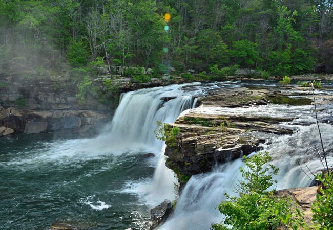
Near Fort Payne, Route 35 cuts across the Little River and creates an easy access point for visitors to enjoy Little River Falls.  Overlooks from each side of the river afford different viewpoints of the river and falls. Here, Alabama Rt 35 signals the northern entrance of the 11 mile Canyon Rim Drive, as well as the 45 foot Little River Falls.
In this closeup view a cool mist rises up out of the falls. The powerful river pours over a ledge in the river bed, pounding the rocks below with a thunderous roar, while sunlight casts a lens flare in the spray-drift. A boardwalk follows along a short section of the river on the northeast side and offers these wonderful closeup views of the falls area.
Area Map
Park Map

|
Additional Points of Interest |
Scenic USA Prints from
|
Copyright © 2020 Benjamin Prepelka
All Rights Reserved

