|
Scenic USA - Utah Burr Trail Road |

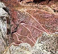
| Photo and Article by Jeff Clark Internet Brothers Burr Trail Road from the air (inset) courtesy NPS |
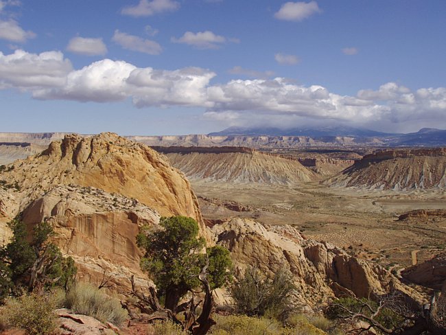
Capitol Reef National Park, totaling 378 square miles, is comprised of colorful canyons, ridges, buttes and monoliths. Here, a 75 mile long up-thrust called the Waterpocket Fold, extending like a rugged spine from the Thousand Lake Plateau southward to Lake Powell, is preserved within the park boundary. Capitol Reef is the name of an especially rugged and spectacular part of the Waterpocket Fold near the Fremont River. Here, rock layers on the west side of the Fold have been lifted more than 7000 feet higher than the layers to the east. Only a few decades ago the country around the Waterpocket Fold made up one of the last remote corners of the Lower 48. Easy access came only with the construction of a paved highway through the Fremont River Canyon in 1962.
Visitors to Capitol Reef are often curious about the orchards that lie within a few miles of the Visitor Center.  These trees are among the obvious remnants of the pioneer community of Fruita, settled in 1880. Today, the orchards are preserved and protected as a Rural Historic Landscape. The orchards hold approximately 3100 trees, mostly cherry, apricot, peach, pear and apple, as well as, a few plum, mulberry, almond and walnut trees. The National Park Service now owns and maintains the orchards with a two-person orchard crew that is kept busy year round with pruning, grafting, irrigation and pest management.
Even though the communities along the Fremont River were self sufficient, connection to outside towns were essential to distribute their produce. Pioneers cleared a wagon trail through Capitol Gorge which allowed settlers, church officials and miners to pass more easily through the Waterpocket Fold. The only other trail to cross the Waterpocket Fold was the Burr Trail Road. Originally a cattle trail blazed by stockman John Atlantic Burr, The Burr Trail connected the town of Boulder to Ticaboo and today's Glen Canyon National Recreation Area. Much of the 68 mile road lies outside the park boundary and traverses the Circle Cliffs, as well as spectacular areas of Long Canyon and The Gulch. The 5.3 mile stretch of road inside Capitol Reef includes a breathtaking set of switchbacks rising some 800 feet in only one-half mile. These Strike Valley switchbacks are not considered suitable for RVs or vehicles towing trailers. From Boulder to the west boundary of Capitol Reef, the Burr Trail Road is surfaced through Grand Staircase-Escalante National Monument. Inside the Capitol Reef Park it remains a graded dirt road and is subject to change due to inclement weather. Visitors should inquire about road and weather conditions before setting out.
Area Map

|
Additional Points of Interest |
|
Copyright © 2020 Benjamin Prepelka
All Rights Reserved
