|
Scenic USA - Montana Saint Mary Lake |
|

| Photos by Ben Prepelka Ben Prepelka Photography |
Powerful tectonic forces created a huge chain of  mountains in today's northwestern corner of Montana. These tall peaks intercepted eastern bound precipitation and began to collect vast amounts of snow. Over time the immense snowfields became glaciers. These earth shaping, massive glaciers disappeared about 12,000 years ago but their effects remain today.
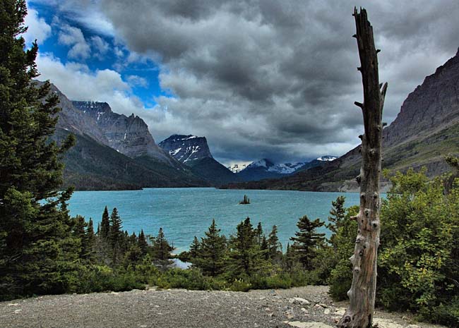
Glacier National Park, lacking the commercialism of America's most famous national parks, has become one of the most popular in the northwest. Located on the east side of the park and parallel to the Going-to-the Sun Road, visitors can't miss this view of St. Mary Lake. The glacial eroded trough now contains one of the park's largest lakes, covering over 4000 acres. This view captures the lake waters, Wild Goose Island and mountains which surround the lake. A web of hiking trails near the western end of the lake lead to the Baring Falls, St. Mary Falls and Virginia Falls, as well as paths along the lakeshore. Some sections of these trails are rather steep, and with the lake's elevation at 4484 feet, the hike can be a challenge. Lake waters rarely rise above 50 degrees in the summer, and are most often frozen-over during the winter. Surrounded by steep-sided gray granite mountains, the lake's deep, crystal clear waters paint an unforgettable scene.
Area Map

|
More Area Attractions |
|
Copyright © 2025 Benjamin Prepelka
All Rights Reserved