|
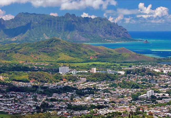
Scenic USA - Hawaii Pali Overlook |

| Photo by Leo Cloutier Leo Cloutier Photography |
Oahuís Route 61, stretching across the southern tip of the island from Kailua to Honolulu, leads to one of the most spectacular overlooks on the island. Here from the Nu'uanu Pali State Wayside Park, on top an 1180 foot cliff, a lofty view looks out over Kaneohe, Kailua, Chinamanís Hat and Kailua Point.
The first highway to Pali Lookout was built in 1898, with a few remnants of this old highway still in existence. During construction more than 800 human skulls and countless bone were uncovered. This was the site of a late 18th century battle. History shows after Kamehameha I consolidated power on Hawaii (the big island), he invaded the Island of Oahu in 1795. Kamehameha, raised in the Waipi'o Valley and earning the nickname of lonely one, went on to unite the entire island chain under his rule. Using western style battle tactics learned from the English, Kamehameha arrived by boat and lead his army into the Battle at Nu'uanu Valley. Eventually, the invaders drove Kalanikupleís forces over the cliff at Pali Lookout.
Here at the overlook a stiff wind may catch first time visitors by surprise. The lower end of the viewpoint leads to Old Pali Highway, and offers a different perspective of todayís Oahu cities and yesteryears' history. The chills here are most likely from a cool Pacific trade wind, but perhaps it may be echoes of the past when thousands plunged to their deaths at Pali Overlook.
Area Map

|
Additional Area Attractions |
|
Copyright © 2020 Benjamin Prepelka
All Rights Reserved
